Tuesday, July 28, 2015

The Badlands (SD)


We headed southwest; but not how most people head southwest.  The grid-like roadways of South Dakota required us to drive the margins of very large land boxes.  This was not the shortest distance between two points, but the militaristic left-right-left was not yet a forgotten skill-set.

At Pierre we crossed the Missouri River, with the intent of staying on the western side of her banks for the foreseeable future.  As Hank easily hummed through the gently rolling, treeless plains; we gazed across the terrestially-carpeted "waves of grain."  The endless uniform greens,  gold, and browns were occasionally dotted with spots of silver.  At first this seemed like an anomaly, but the more we drove, the more silver speckles appeared.  As we passed a farm sitting adjacent to the roadway, we realized the origins of these shinny masses.  The intense storm that damaged Pierre (and spared us!) had rolled across the plains like a freight train.  Large silver grain bins had been torn from their concrete anchors and tossed across the cropland.  These massive seed impoundments had been reduced to crumpled skins of metal pieces, and strewn for distances of over a mile from their origin.  Life on The Plains can be harsh.

Remnants of grain bins lay crumpled and scattered across the crops they once stored
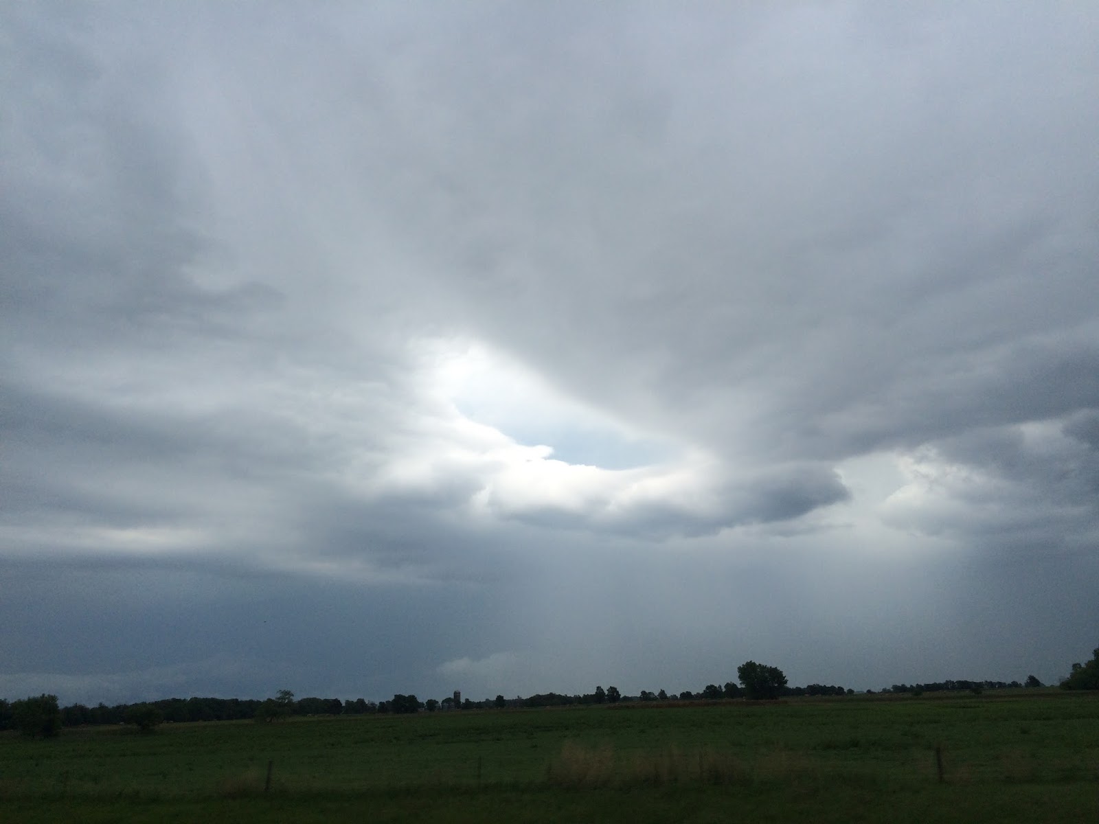
We made a southward turn at Philip--a nondescript crossroads where a solitary ball field now sits with its stadium lighting towers recently strewn at various angles onto the field.  From here the rolling hills began to gain more edges; as well as more disparity between valley and plateau elevations.  As we crested the pitching hillsides, the southern horizon began to slowly unveil the sudden topographical departure that lie ahead.


Natures beauty combined with almost impassible terrain yields a product known as The Badlands.  Standing like defiant sandcastles against the weathering that continues to etch their profile, these wonders present themselves as ancient temple ruins ringing the much smoother and fertile valley floor below.  

Painted with a pallet of pale, pink, and pumpkin pastels; these prominently projecting pinnacles--precariously perched on pre-paleolithic plates--perpetually piercing perpendicular into the contrasting cool chasm of cottony cumulus clouds churning within the celestial-colored caldron ceiling.
The constant battle between earth and water has left sheer cliffs and narrowing/harrowing gorges that plunge hundreds of feet down steep inclines.  When in its normal arid state, the clay and rock meld into a solid stratus that stands like a marble statue.  When the rains arrive, the bond is broken--with the clay creating an unstable swelling and melting down the steep slopes to turn the valley streams milky brown.  The rains make this topography much more dangerous for traversing.  Unseasonable rainfall amounts even more so.  Over the preceding 3-weeks, 19" of rain fell on this region.  The annual average is 10".  This had the unfortunate result of creating landslides throughout the park; including one that left our passage into the park partially destroyed.

With no vacancy in the unshaded park campground we opted to stay at a private (and heavily shaded) KOA a few miles south in the town of Interior.  The campground was large and spacious, and laden with comfort amenities (showers, laundry, a swimming pool, a dog run, and a well-stocked camp store).  This very comfortable oasis was a great place to end our days of strenuous exploration of the adjacent rugged and harsh terrain.

The Badlands are truly a "Wonderland."  

It is a wonder how the topographical nuances of this park are only found within this regional foci, as the climate and substrata can be found in the nearby grass-laden rolling hills.  It is as if a great river--miles across--once rapidly flowed through this region; suddenly drying up to reveal the post-hydrologic contours that distinguish this area from the adjacent smooth and fertile hills.


It is a wonder that there is such a diverse compendium of flora and fauna.  From the peak-seeking big horn sheep to the subterranean prairie dogs; from the nocturnal burrowing owls to the diurnal ferruginous hawks; from the carnivorous swift foxes to the herbaceous bison; this rocky wilderness serves as a sustainable habitat for a wide variety of robust wildlife.


It is a wonder that early settlers were able to successfully navigate this monstrous maze of rock, clay, and cliffs.  For the westward-minded Americans who chased the promise of a better life beyond our existing States, the sight of this could have provoked both inspirational awe and ominous discouragement.  To transport family and livestock through a region fraught with danger from both man and nature would certainly conjure-up a descriptive title--Bad Lands.  Those who successfully traversed natures gauntlet to carve a life at points further westward were certainly robust people.


With the onslaught of recent rains, our hiking was fairly limited.  The soil composition at the surface is comprised of dusty clay.  When wet, it becomes both ultra-sticky and untra-slicky.  A brief stroll down a recently precipitated path will result in the addition of a few pounds and a few inches to the bottoms of your feet.  Removal of this portable quagmire can be time consuming--through meticulous debreding of boot treads, or by letting the earthen spackle dry until it can be broken from its poda-form.  Attempting to tread on more elevated perspectives can lead to a dangerous sliding down one of the aforementioned drop-offs.  Bad lands indeed!


The sunsets were beautifully breathtaking.  The sheer cliffs with their multi-colored banding, continued to morph through an ever-changing spectrum; the setting sun providing both vibrant hues of orange-reds and contrasting darker tints amongst the shadows.  It is one of the few places I've experienced where the sunset can be spectacular while looking either East or West.

wWw


Sunday, July 26, 2015

Lake Ohae-Missouri River (SD)

Fishing for Walleye at sunset as turbulent clouds move across The Plains
We followed Route 50 west of Yankton until we reached Wagner, then adjusted our heading to 360-degrees on Route 281.  With a 125-mile stretch of road ahead of us, and a robust tailwind to economize our fuel, we decided it was time for Kristy to sit in the Left Seat.
"You guys are going to put me out of a job." -- Tom Petty; Breakdown (Live from the Pack Up The Plantation album)
The first few miles were incredibly awkward.  The "feel" for the 35' of trailer in-tow was much different.  The uncomfortable chucking feel of the hitch under the 6+ tonnes of towing weight.  I immediately HATED sitting in the Right Seat.  I was trying to navigate, check weather, calculate time-marks to the next town; meanwhile, Kristy is kicked back and letting Hank do all the work.  I had no idea how much I relied on "the tiller" to keep my in-vehicle motion steady.  
"Trouble ahead, trouble behind..." - Grateful Dead, Casey Jones
The tree-covered landscapes were now behind us, and there was nothing but rolling cropland on all sides.  The scenery was HUGE.  Even the cloud formations looked impressively large.  We were in-and-out of cellular range, so when I once again acquired a signal, It was immediately clear why the clouds looked so large...they were!
Looking into the eye of the storm, and seeing it look back at us
Ahead of us--moving at a trajectory perpendicular to ours--were two super-cell storm formations with an array of pretty rainbow colors on satellite imagery.   With the soothsayers from NOAA prophetesizing an apocalyptic future of large hail and dangerous sheer winds in excess of 60 MPH, we kept our eyes on the darkening horizon.  The first storm crossed our path 5-10 miles ahead of us, making a bee-line for the town of Huron.  Amateur video of this hail storm can be seen HERE.   
"Scotty! I need you to get us out of here now!" - Captain James T. Kirk; just about every episode of the original television series "Star Trek."
All projections had us intercepting the core of the second storm at Redfield.  We pulled The Rig over, let The Boys take a very quick nature break, switched seats, and drove at a brisker pace.  Although not listed on the map, about 8-miles south of Redfield we reached "providence" (population: 1 very powerful guy).  The second storm slowed and took a more southeastern trek; completely sparing us from any wind/hail encounters.  At Redfield we turned due west and spent the afternoon chasing the sunset and admiring the northern edge of a really impressive storm.  


Gettysburg, SD: More picket fences; less Pickett's Charge
As we neared our next destination, we drove through a small town with a famous name--Gettysburg.  This name recognition wasn't lost on the locals, who made sure nobody inadvertently mistakes this place for the one where Lincoln spoke with brevity.  Gettysburg was a small western town that revolved around agriculture and grain motivity.  I don't know what the official population is, but I'd be willing to bet that there are an equal number of grain bins.


RV-top panorama view of Bob's Resort
Seventeen miles beyond Gettysburg; where the road crosses the Missouri River into the Cheyenne River Indian Reservation, sits Bob's Resort.  Bob's Resort has been a local convenience store/bait shop/RV park/restaurant since 1960.  We checked-in with one of the surviving sons of The Late Bob, and backed into our full hook-up site.   Bob's RV park is mostly a local/regional destination for anglers infatuated with walleye.  Everyone--except us--was using Bob's proximity to the East Whitlock boat ramp, where walleye are plentiful in the deep waters around the adjacent bridge.  Our non-fishing presence--coupled with our Texas plates--gave everyone something to talk about when they weren't talking about walleye. 


The Boys tracking Walleye in the cold Lake Ohae-Missouri River waters
We used Bob's for three principle items: 1) establish a temporary mailing address to receive our "mail call" package from Virginia; 2) position ourselves for an easy drive into Western South Dakota; and 3) be reasonably near a RAM dealership for Hank's periodic maintenance.  The weekly rates were about the same as 4-days at the daily rate, so we booked for a week and decided to leave when we felt like it.
Bob (owner of Bob's Country Bunker): "Well I'm sure glad to have you boys here.  I'm Bob and this here is my place."Jake Blues: "Well it's a b'yootiful place Bob"  -- From the motion picture The Blues Brothers

The weather was a bit warmer than in Yankton, but that was due to the paucity of shade being cast on Glory's roof.  "Paucity" as in ZERO trees of "shade size" near us.  Most days were sunny and clear, but in the evenings thunderstorms could be seen developing in the western skies.  The beautiful Big Sky provided an enormous canvas for the rose-pastel thunderheads to develop in the foreground of the sinking sun.  

One such evening we watched the sun set behind an enormous army of rapidly massing clouds.  The radar confirmed our suspicions of a long night ahead.  With the trifecta forecast of hail, strong winds, and possible tornadic  activity; I readied a bug-out plan and took the graveyard watch.  In a second instance of Providence, the storm weakened to mostly a rain event and bisected to the north and south of us.  I didn't get a lot of sleep, but what I did get was sound.


The meteorological equivalent of a bar fight where your friends walked out on you.
The next day I took Hank for his periodic "oil and lube spa" at the dealership in the capitol city of South Dakota--Pierre.  The hour drive south was a repetitive video-loop of crops extending into the horizon, with brief intermissions of grain elevator cities extending into the otherwise unobscured skies.  When I reached Pierre, the damage from the prior night's storm was evident.  Large hardwoods pushed over, cars damaged by flying debris, roofs partially peeled back on western-facing mobile homes.   Clean-up crews were abundant, and when I queried the staff at the dealership about the storm, the details were daunting.  Eighty MPH winds plowed through the city in a straight-line attack.  Characteristic of these hardy souls, they immediately commented that they didn't have it as bad as the next town over, where winds blasted through at over 110 MPH.  

Hank finished his spa treatment, so we took the more scenic Missouri River route back.  Even with the sparsely distributed trees, the rolling hillsides covered in wind-bent grains was quite beautiful.  We stopped at various points along the journey back to take in the unique sights of the northern plains...and to avoid hitting one of dozens of pheasants that were strangely drawn to the middle of the road.


A small strand of trees stand tall above the endless fields of grain
On Father's Day morning Kristy and I were in the middle of our daily caffeination ritual, when I noticed a man running past our RV with an incredibly small RV fire extinguisher in hand.  Various communities across Our Great Country have unusual traditions, but something told me that I should  investigate this activity further.  Four campsites away from us was a small gathering of people watching one man with a Lilliputian-sized fire extinguisher, and another with a Ronco Pocket Hose (As Seen On TV) try to quench a blazing engine fire in an antiquated Winnebago-style camper.  The flames--initiating in the engine compartment--had spread into the interior dashboard, and proceeded into the over-the-cab sleeping bunk.  THIS was a hot mess!


Gettysburg volunteer firefighter heads back to his Father's Day lunch
Being just before noon on Father's Day, the members of the Gettysburg Volunteer Fire Department would just be exiting their local parish en route to a local Sunday buffet.  A 10-minute notification time, plus another 10-minutes to drive to the firehouse, plus another 15-minutes to travel the 17-miles from town...would result in a burned-out camper.  I grabbed our extinguisher and a water hose and headed to the burning camper.  Hooking up to a neighboring water source, I partnered with the Ronco Pocket Hose fella and we proceeded to direct copious amounts of limestone-flavored water onto the fire.  By the time the volunteer fire department arrived on-scene, the fire had been reduced to a smolder, and the curious on-lookers had returned to discussing the weeks bounty of walleye.  The Father's Day cookout ended as quickly as it began.

Editor's Note: From a purely investigative standpoint, this was the second camper fire that we had witnessed in a few months, and both involved campers that had been static for a couple of years.  A trend of unchecked faulty wiring (gnawing mice?) was emerging.

With our mail in-hand and Hank feeling rejuvenated, we decided it was time to move the caravan.  We were both a bit excited about the next destination, as we were now at the threshold of an array of massive natural wonders and inspirational landscapes.  We were about to step into the "Interior" of The West.

wWw

Saturday, July 25, 2015

Pierson Ranch - Yankton (SD)

2-mile straight-away across the Fort Randall Dam into Nebraska
Onward. Northward.  Driving parallel to the Missouri River and the passage first mapped by Lewis & Clark.  With Nebraska on our left and Iowa on our right, we drove a relative straight and level route towards The Dakotas.  At Souix City the Missouri River takes a turn to the northwest. We followed suit and continued to see where this mighty river led us.  We steered Hank onto the Exit 26 off-ramp and motored into the South Dakota visitors center.  The volunteers were very friendly, and we left this well manicured rest area with several pounds of literature on how to best leave our money in South Dakota.

We crossed over the interstate and followed Route 50 as it continued to parallel the Missouri.  When the Missouri briefly turned into the Lewis & Clark Lake, we had arrived at our next bed-down location--Pierson Ranch in Yankton.

Pierson Ranch (State Recreation Area) is a small campground that sits in the shadows of Fort Randall dam; a 10,700'-long/165'-high blockade of the Missouri that results in the creation of The Lewis & Clark Lake.  The campground is smallish compared to several that we've visited, with a couple-dozen level and paved pads providing electric-only service.  The campground had a park-like atmosphere, with the lush green fescue meticulously maintained.  The split-rail fence that establishes the campground boundary is lined with a variety of native and non-native evergreens.  The interior is heavily populated with a variety of shade trees--most notably cottonwoods; whose constant feather-light, powder-puff sheddings gave the effect of a light snow falling throughout the summer day.  

The camp hosts were very accommodating and helpful; offering to come to our reserved site to check us in.  The showers/bathrooms were cleaned daily by a contract vendor, and the cleanliness (plus great temps and water pressure) tempted me to give up the familiar surrounds of the RV and utilize better amenities.  We even had our firepit cleaned daily by one of the contracted staff.  Excellent service and a reasonable price!

Surrounding the campground is an extensive Frisbee golf course, children's playground, and paved pedestrian/bicycling trail that is part of a larger trail system spanning dozens of miles.  The downstream side of the dam houses another state campground, as well as an Army Corp of Engineers campground.  The camping opportunities are vast on the downstream side of the dam, yet pale in comparison to the massive Lewis & Clark State Recreation Area on the upstream side of the dam.

Kristy hikes the arid trails amongst the junipers bringing memories of Texas Hill Country
This area is flush with outdoor recreation amenities, and both South Dakotans and non-residents pack these campgrounds to take advantage of the beautiful terrain.  The stereotypical "flat, windy, & boring" descriptors of South Dakota do not apply here.  The terrain is rolling bluffs that overlook the lush Missouri River below.  The valley area is littered with fully-matured shade trees that could easily be mistaken for river regions in Tennessee, Arkansas, and North Georgia.  The terrain on the higher bluffs is steep and rugged, with dense thickets of junipers clinging to the dry, clay soil.  This scenery is a mirror image of the rocky elevations found in the Texas Hill Country.

Those who weren't here simply for the camping and beautiful mid-70's weather were here for the fishing.  Bank fishing, boat fishing, fishing off the dam spillway, and (most interesting to us) bow fishing.  On the south-side of the dam was a small flotilla of flat-bottom boats with home-made, raised platforms on the bow.  From this elevated position, fishermen would shoot large fish--namely carp--with a bow and arrow.  This is such a popular activity that many businesses in the nearby town of Yankton display signs welcoming "The Archers."

The Boys taking time to enjoy the water activities at Lewis & Clark Recreation Area
The nearby town of Yankton is a smallish town that is large enough to have consumer amenities (i.e. Walmart, regional hospital, large chain grocery), but small enough that there never seemed to be any crowding or traffic.  The locals were incredible friendly and polite, and any act of courtesy (like opening a door for someone) was immediately followed by a sincere show of gratitude.  There was an obvious sense of pride in the community, as sidewalks and gutters were constantly swept and maintained in immaculate condition.  

The Lewis & Clark Meat Lodge: A Carnivore's Nirvana
This location was initially projected as a 1-2 day layover, but the weather, scenery, and wonderful personalities encouraged us to extend for a few extra days.  Such a nice community.  If they didn't reach -10F (and the land were more affordable), we would've given this area of the country a little more consideration as a retirement location.

Onward.  North Westward.  Following the Lewis & Clark path as best we can in an RV.  Headed to another spot on the Missouri River; home to big walleye and Big Sky Country.

wWw

Friday, July 24, 2015

Wilson Island State Park (IA)

If Lewis & Clark had dogs...

The northward route from Kansas City is a passage that had been laid years ago.  This is the Lewis & Clark pathway, and we were not going to buck success in our journey through the Northwest Passage.

We drove  against the current of the Missouri River, traveling along the eastern bank into Iowa.  The rolling hills and jetted bluffs are a signature trademark of "The Hawkeye State," and these bluffs were immortalized in the Lewis & Clark expedition as a location where they held a "Council" with the Native Americans.

We set our sights on a pseudo-remote campground that sits on the banks of the Missouri River just north of Omaha, Nebraska.  Wilson Island State Park sits within the confines of the more expansive De Soto National Wildlife Refuge.  The I-29 off-ramp pig-tails westward down unpainted secondary roads that traverse exceedingly flat Iowa cropland.  If it weren't for the familiar brown recreation area signs sporadically located along Iowa Route 30, one could quickly began to think that they were thoroughly lost.

Wilson Island State Park is geologically interesting.  In addition to bordering the Missouri River, it also hosts a man-made lake that at one time was part of the Missouri River.  As the Missouri River snaked between Nebraska and Iowa, large curving loops were established.  By damming-up this loop and redirecting the river in a more straight-line path, an "ox-bow" lake was formed.  Even more interesting is that the original state boundary--which was located in the center of the Missouri River--remained unchanged. This resulted in a section of Nebraska being located on both the eastern and western banks of the Missouri River. 

Iowa continuing to earn it's boring reputation with this "over-the-top flashy state-line sign."

With a portion of the Missouri River now being part of De Soto Lake, historical findings  along the river are now part of the interior lake.  The steamboat Bertrand is a good example of this, as it was discovered in the man-made lake, 97-years after sinking.  The well-preserved artifacts of this vessel are on display at the nearby Bertrand exhibition center. 

We arrive at the campground by mid-afternoon and selected one of the non-reservable ("walk-up") sites.  It was at this point that we discovered our site was not a full hook-up (sewer/electric/water), nor was it a traditional "partial hook-up" (electric/water).  This campground was electric only, so we made another victory lap and headed to the potable water point.  After filling Glory's 70-gallon fresh water tank, we were ready to set chalks.  

The campground's limited amenities were fairly new, as most things were rebuilt following the serious flooding of 2011.  Always weary of natures destructive forces, we scouted the campgrounds relative distance to the Missouri River using an on-line mapping site.  Oddly (and eerily) enough, the map showed the campground during the 2011 flooding. With most access roads underwater.  It was somewhat comforting to see that--although an island--our choice of campsite was not underwater.  When we filled our potable water tank, we noticed an "advisory" sign regarding the "EXTREMELY high level of iron in the water."  We had pre-filters for our drinking water, so we didn't give this much thought.

ALWAYS...ALWAYS...ALWAYS...carry an AM radio with you (and a life vest).
This park did not have any camp hosts, but we received a hero's welcome the second we exited our vehicle.  Mosquitoes.  Swarming mosquitoes.  Moses-style plague mosquitoes.  For the first time since we hit the road, I diverted away from my set-up algorithm and focused on finding a large quantity of DEET.  Kristy was easily convinced into focusing on "inside work," and The Boys" were not chewing-at-the-bit to exit Hank.  The threat of partial exsanguination had out set-up procedures moving at a pace similar to NASCAR pit crews.

With set-up completed, we retreated to the proboscis-free confines of the RV.  Unfortunately, the security of the mosquito-free zone had to be abandoned--time to walk The Boys.  As the malaria machines salivated outside the screened enclosure, we grabbed the leashes and made a date with anemia.  The walk was a cardiovascular symphony; with a walking pace that rivaled the toughest cardiopulmonary stress-test, and a hand-waving mosquito-slapping XP-90 upper-body workout.  It was probably the most exercise we had undertaken in months.

Relief was in site.  High winds and heavy rains were forecasted, and (for the first time) we welcomed anything Mother Nature could throw at us to reduce the mossies.  As an added precaution, we ventured into Omaha and purchased a Coleman pop-up screen room.  We were finally able to enjoy the outdoors again!

About the second day I began to notice a somewhat disturbing trend--my wife was not flushing the toilet after each use (#1).  Cognizant that we were at our first campground where we did not have a "city water" hook-up, I let it slide while I contemplated a way to address this in the most loving, husbandly way.  Shortly thereafter, I discovered that the "tea colored" liquid was not of human origin, but rather the result of EXTREMELY high level of iron in the water (see aforementioned water warning above).  As I thanked The Almighty for not allowing me to wrongly accuse my wife of breaching sanitary etiquette, I could feel the marbles forming small solar systems in my kidneys.

Panorama photo of our camping site at Wilson Island State Park, Iowa.
We spent a few days along the fast flowing Missouri, but the high temps and humidity (and mosquitoes) motivated us to press onward.  We dumped our tanks--including the 500-pounds of fresh water--and followed The Lewis & Clark Trail towards The Dakotas.

wWw

Wednesday, July 8, 2015

Reunion at Lake Paradise (MO)

"They talked in the shorthand of old friends and shared memories."  - Dee Henderson; Before I Wake
Terrie, Bradley, Kristy, & Wes at Lake Paradise, Missouri
The military life is one of certain uncertainty; of unfamiliar familiarities.  Complete strangers—up-rooted and relocated to strange surroundings—are compelled to form a bond for mutual survival.  This scene has played out millions of times throughout the millennia, and continues until today.  Some bonds are temporary.  Some are permanent.  Regardless of the longevity of these bonds, it is understood that life within the profession-of-arms is transient.  With the exception of airline flight attendants, there is probably no other profession that says “goodbye” as often.  So when an opportunity presents to reunite with a fellow Airman, the occasion is always special.

Everyone has rough stretches of road in the course of their lives.  It is expected—but having solid support during those times is a luxury and a blessing.  In the early days of my Air Force career, my life path took me to Langley AFB, Virginia.  It was during this time that my “life’s pathway” crossed the pathway of another young Airman—Bradley Williams.

Brad and I hit it off immediately, and possessed some of the same characteristics and interests.  We became good friends, and subsequently deployed together during OPERATION DESERT SHIELD/DESERT STORM.  Upon our return from the war we remained friends, and continued our careers within our respective professions.  Bradley was always striving to better himself, so it was no surprise that he would not settle for the Emergency Medical Technician required of his career specialty, but rather attain the much more advanced Paramedic Certification.  His perseverance in pushing himself to remain a student of his profession inspired my wife Kristy to attain her Paramedic Certification as well.  

A few years pass and Brad came to the crossroads that all military members reach every 4-6 years—remain in the military or make the transition into civilian life.  Brad decided to leave the military, but continue his medical expertise in emergency medicine.  We said our goodbyes, wished each other the best, and hoped that our respective paths would cross again…someday.

Seventeen years later.

I had returned from Okinawa and was on Terminal Leave awaiting my final retirement date.  Out of the blue I received a message (via FaceBook) from Brad.  We exchanged a few greetings and niceties, but it had been a long time since we’d last met, and I was unsure if he’d even recognize the free-wheeling, living-on-the-edge rebel that I no longer was.  Time changes everyone, and it has certainly done an extreme makeover on me.

His Facebook profile listed him as working with disabled veterans (no surprise there) in the Kansas City area.  Since Kansas City was not on our Chrysalis-L tour  listing, I didn’t have any great expectations that we would cross paths again…someday.  Now that the moons had aligned, and we were within a few hours, we knew we had to make some type of attempt to reconnect in person.  You never know if you’ll get this chance again…someday.
"Older times we're missing, spending the hours reminiscing.” - Little River Band; Reminiscing
I contacted Brad and let him know of our travel route through the Kansas City area.  Kristy and I selected a nice RV resort south of Independence, Missouri; and we arranged a date to have our own 3-person reunion.  Our faces and bodies were older, with more mileage than the odometer truthfully displays; but we reconnected just where we left off.  Brad was intuitive enough to realize that I was a rookie when it came to being a civilian—with a paucity of retiree attire—so he brought me an “island shirt” (which I didn’t have any of) and an official veterans hat (OPERATION DESERT STORM series).


Crusty 'ol retired veterans club
As Brad & I reminisced, he recalled times in my life—good times—that I had completely forgotten.  He resurrected names of people that time had erased from my memory.  He filled-in missing pieces of history that I was unaware of regarding mutual friends—telling of their successes and influences on other peoples lives.  I was experiencing an oratory version of a dusty old photo album encompassing my earlier years.  Since Brad was also a mutual friend of Kristy, she was taking a walk down amnesia lane as well.  


Perfect end to a day: watching the sun set while fishing next to the campfire
Brad and his wife Terrie spent a few days with us at the lake, telling stories (mostly true), fishing, and taking in the sunsets.  Our wives even let us take a solo trip to Walmart dressed in our island shirts and veteran hats…and hopefully that surveillance video has been taped over by now.  

Similar to the scene seventeen years earlier, we exchanged goodbye hugs, dried our eyes, and wished each other the best.  The downside of the transient lifestyle was still fully understood.  It was nothing short of a blessing to be able to reconnect with such a loyal friend from days-gone-by.  As our lives continue to morph into the future, we still remain uncertain as to how many times we will get the opportunity to break bread face-to-face; but we both know that we have every intention on reconnecting again…someday.


He ain't heavy, he's my brother.
wWw

Tuesday, July 7, 2015

The Farmhouse at Parsons (KS)

Yesteryear Awaits
After sitting at the high-point of Arkansas for a week, we were again packing up and heading onward.  The northern departure route from Mount Magazine was not as harrowing as the southern accent route, and Hank was showing his appreciation as his engine purred through the curvy, downhill plateau.   
No trip to Paris is complete without a photo of the Eiffel Tower
In 2001 we celebrated our 10th wedding anniversary in Paris, France; in 2012 we visited Paris Texas; and now we found ourselves rolling through Paris, Arkansas.  Taking one's wife to Paris three times sets the bar pretty high on the "Great Husband Scale," and I apologize for putting any undue pressure on my male friends.

Miner statue at the Paris Logan County Coal Miner's Memorial
Paris is another quaint little town that is representative of Americana.  The town was built on hard work, and still values the sweat-equity that makes our society prosper.  On the southern edge of town is a static display of one of the most dangerous and demanding jobs in America--coal mining.  This display not only serves as an interactive site--complete with actual period machinery and coal--but also serves as a memorial to all the men who lost their lives while performing their trade.  The days of coal may be drawing to a close, but this town will remember the efforts put forth to bring commerce to their community.

Coal car on rail loaded with the fuel of the industrial age
We were headed northwest towards Kansas.  Considering our constant maneuvering away from severe weather, Kansas during the tornado season seemed like a fools folly.  No argument here.  Although the RV inspection during our departure from San Antonio gave Glory a clean bill of health, she needed fixing.  During our stay at the Lackland AFB FamCamp, we noticed that the galley tank would leak when it was nearly full.  After removing the underbelly and inspecting closer, I noticed stress fractures at the drain where the leak was originating.  With the underbelly exposed, I inspected the grey & black tanks, and saw the beginnings of similar stress fractures.  After a failed attempt to "chemically weld" a patch over the fracture sites, we called the manufacture and scheduled an appointment to have all the tanks replaced.  The appointment was nearly 2-months out, but it was a date...and Glory was headed home.

Our house would be in the shop (that just sounds crazy!), so we would need a place to kick-it for a few days.  Since we needed to empty out "the basement" to allow access to the holding tank plumbing, a motel wasn't going to cut it.  We did a cursory search for vacation homes for rent within a 1-hour drive of the NuWa factory in Chanute, and found the perfect spot.  

Situated 40-minutes south of Chanute, Kansas lies the small town of Parsons.  The terrain is relatively level, the roads straight, and the people very hospitable.  We knew we had arrived in small-town America, as we passed a girls (~12-14 year olds) softball game and the stands were packed.  Obviously more than just parents coming out to support these adolescent athletes.  

Glory resting in the company of farmhouse & fields
We continued down the blacktop road and turned onto a dirt road towards our bed-down site.  At the end of this dirt road sits an early 20th-Century farmhouse that has been painstakingly renovated into a vacation home.  The cozy one-story abode sits amongst trees and acreage, providing spacious privacy with views across the adjacent fields of tall grasses.  The hostess--Debra--met us at "The Farmhouse" to get us checked-in.  The folks here are really down-to-earth, and although we were technically in the middle of a lodging business transaction, it was like we were talking to our neighbors across the fence.  This was "Heartland hospitality" at its finest.

After unloading the basement contents in the smallish detached garage, we settled in and acquainted ourselves with The Farmhouse.  Growing up in a rural setting amongst older homes, I was instantly taken back in time.  The warm antiquated feel was like traveling to the country to visit Grandma...and yes, there were cookies waiting on the kitchen counter for us.  Nothing short of a hidden gem for the vacationer or traveler, we easily gave our highest praises for this tucked-away treasure in our on-line review.
Modern meets nostalgic in this charming little farmhouse that has been personally restored by the owner.  For anyone who has visited or lived in an early-1900's home, you will immediately feel the cozy layout that was typical of that era.  This two bedroom abode sits on secluded acreage, allowing solitude amongst the adjacent fields and wooded areas.  One can breathe-in the clean Kansas breeze while swinging under mature pecan trees, or sunbathe on the large back patio.
The interior decor is warm and welcoming.  A plush leather couch immediately welcomes the traveler upon entry through the original front door.  The kitchen boasts a full-sized refrigerator and glass-top range; both nestled amongst the original custom cabinetry that has witnessed decades of home-cooked meals.  The bedrooms are light and airy, with each providing a countryside view through updated windows.  The bath was our favorite upgrade, with a generously sized walk-in shower that rivals those we've encountered in upscale hotels during our world travels.
Our hostess Debra was very accommodating, readily available, quick to respond, and always pleasant in conversation.  She has meticulously selected appropriate period items to keep the "feel" of the farmhouse; seamlessly blending them amongst the modern amenities (flat-screen TV, Wi-Fi, etc.) that travelers expect.
We had never visited Kansas before; but should we return, this taste of Americana will be part of our travel plans.                   - W. Walker
After a great nights sleep, Hank and I were taking "The Homecoming Queen" back to her place of birth.  We headed north, passing miles of agricultural scenery.  The drive was like an interactive exhibit on how to feed a nation.  Croplands stretching into the horizon, bordered by silos and dated railways to move their botanical bounty.  Long straight highways that were speckled with grain carriers, as well as the occasional tractor making its way to the next endless field. 

I was 10-minutes early for the 0700 drop-off, and the service manager--Wayne--was waiting for me with clipboard in hand.  The old military adage of "if you're not 15-minutes early, you're late" must have been created here.  He greeted me by name, gave me a quick confirmation of the work I had requested, and showed me where to unhook Glory.  Nothing like a rock-solid work ethic and service to give your customers confidence in your product.  

I was badly needing coffee, and was actually quite hungry.  I headed into the "downtown" section of Chanute to see if I could find some breakfast vittles.  I didn't know where to go, so I looked for a restaurant with a lot of cars parked out front.  I didn't find the cars, but I found a restaurant with a lot of work trucks.  Jackpot! 

The Grain Bin is a throw-back cafe that has been part of this community for decades.  The walls are adorned with a variety of nostalgic oddities, from certificates of completion in "window dressing," to farming tools which have long been replaced by modern mechanized processes.  There is a small counter--complete with a half-dozen stools--and the remainder of the seating comprised of naugahyde covered booths.  I can only imagine how many Naugas gave their lives to decorate the dining area. 

The Grain Bin: Eggs any way you like...anytime you like!
The menu is working-class cuisine.  Eggs...any way you can cook 'em. Bacon...crispy. Coffee...strong.  It also comes at a working-class price, with most gut-filling plates under $5 (unless you throw a steak or chop on the side). 

Hearty Heartland Sunrise Vittles
The breakfast club gathering is mostly comprised of blue-collar workers about to hit the day running, and work longer than the sun shines.  The conversations are prudent, but don't include global warming, European monetary issues, or defining marriage or gender status.  These folks talk weather, crops, fixing equipment, fishing, and local sports.  When the apocalypse hits, the subjects won't likely change.

I headed back to The Farmhouse to spend a few days relaxing under the shade trees and exploring the local venues.  Two days later we were contacted by the folks at NuWa telling us Glory was ready to go.  We all loaded up and headed back to Chanute to pick-up our house.  Since the folks at NuWa had finished the job a day early (see customer confidence remark above), we spent it doing some general maintenance, to include washing...well...everyone.  

The few days at The Farmhouse confirmed our vision of owning a farm one day.  We really fell into an uber-relaxed mode and talked about how much we missed working in the dirt.  The stay served as a re-charge and re-inspiration.  We said our farewells to our hostess--exchanging contact info--and rumbled down the straight, level rural roadways. 

It had been a month since we last broke bread with our friends in San Antonio.  We were about to have another reunion; one that has been in the making for 17-years.  We set our sights northward--towards Kansas City.

wWw

Saturday, June 27, 2015

Top O’ (th’) Zark

Rain.

Just about every state around us was reporting record breaking rainfall—and roadways closed due to flooding.  We needed to continue our trek northward and had two options: take the more scenic and flood-prone backroads (89 miles/< 2-hours) through the Ouachita Mountains; or take the more reliable and longer Interstate route (280 miles/~4-hours) around Little Rock.  Why I even mention the more conservative path is beyond me.

Hank was pulling Glory through some beautiful mountain passages.  Along the way we were privy to the extent of the flooding; as large temporary lakes appeared on both sides of the roadway—with corn stalks serving as lily pads as they struggled to stay above the waterline.  The extent of the crop damage was a daunting sign as to what some people would have to overcome to pay this year’s bills.


Panorama sunset over Mount Magazine
As we transitioned from the Ouachita Mountains into the Ozark's, we crossed a low-lying (and flooded) plain that gave a great visual of our next destination—Mount Magazine.  Mount Magazine rises up from the valley in a spectacular fashion—giving the impression of a much higher elevation than the modest 2,753 foot summit.  The southern access road is a steep, narrow set of switch-backs that had Hank revving-up the RPMs while staying in the lower gears.  Glory wasn’t merely a spectator, as one particular exceedingly tight 180-degree hair-pin turn resulted in loud metallic creaks echoing from her flexing chassis.  Everyone was working hard that day.

When the kingpin that joined the two was disconnected, we found ourselves (again) in the relative solitude of a sparsely populated campground.  The wind weaving through the elevated forest provided ample oxygen to maintain a hearty campfire; and the traveling crew basked in the light of distant stars that were undiminished by light pollution.  With the exception of Buddy spontaneously escorting an uninvited raccoon to (by his definition) "the outside perimeter of our campsite," there was nothing stirring except the leaves in the wind; the crackling of seasoned wood; and the symphony of cicadas. 

Mount Magazine is situated in the northwestern corner of Arkansas, and is home to the highest point in all of Arkansas.  Adjacent to the campground is a trail that leads to the pinnacle point of this mountain—Signal Hill Trail.”  At the top of this short (<1-mile RT) trail is a horizontal stonework in the shape of Arkansas.  Of particular interest is that all of the stones used to create this work of art are stones representative of the various geological regions within Arkansas.  From sandstones of the southeastern river basin, to granite in the northwestern regions; this “to scale” exhibit reflects the variations of substrate across our 25th state.


Arkansas state map in native stone
The park as a whole is simply beautiful in every facet.  There is an enormous lodge that sits atop a monstrous bluff, providing incredible views across the valley below.  The interior is constructed of native timbers and stone, creating a fluid blending of the interior styles and the surrounding environment.  There are also a series of cabins situated along the same bluff, providing even more personal space while not compromising on the natural scenery integration.

Steep bluffs, lush forests, and a blanket of clouds above
The nearby Overlook Drive gives breathtaking views to the Northwest and Northeast of the park.  This one-way paved thoroughfare is adorned with numerous overlooks of the valley below.  These towering bluffs—coupled with the sheer cliffs—provide an inspiring and intimidating view into the distance.  In addition to the overlooks, there are a few stone structures and secluded outcroppings to find solitude in the clouds.  It was at one of these outcroppings that we were able to capture a lightening storm rolling across the valley below, and eventually moving onto the mountain where we were watching from inside a stone shelter.  The video below would've been longer, but the unpredictable lightening strikes forced us to move along before the storm-front passed over us.  Still, nobody puts on a show like nature.


For the pedestrian-minded, the Bear Hollow Trail is a 3-mile trail that has some of the most spectacular views in the park—crossing numerous creeks (which feed waterfalls below); overlooking towering bluffs; and crossing through some of the oldest uncut forest in the park.  


Capturing memories on a bluff adjacent to the Bear Hollow Trail
From within our parked location at the Cameron Bluff Campground, we could walk to most of these trails/overlooks while giving Hank a much deserved rest.  There was even a moderate trail adjacent to our camp that wound along mid-ridgeline as it made it’s way back to the visitors center.  The views were not as noteworthy, but the continual access to a multitude of springs made this a favorite trail of The Boys.


River trekking with The Boys
In our 7-months of travels, this easily ranked in the Top-2 of beautiful camping destinations.  The only possible way our stay could have been better, is if we were able to experience the explosion of fall colors.   We needed to keep moving, but we both knew that we would return again to this "Island in the Clouds."

wWw